THE AVIATION
OPERATION SYSTEM™
Transforming fragmented aviation data
into actionable intelligence.
One platform to collect, integrate, reconstruct,
visualize, and analyze aircraft motion from
multiple independent data sources.
Lorem ipsum dolor sit amet, consectetur adipiscing elit. Nulla euismod condimentum felis vitae efficitur. Sed vel dictum quam, at blandit leo.
Lorem ipsum dolor sit amet, consectetur adipiscing elit. Nulla euismod condimentum felis vitae efficitur. Sed vel dictum quam, at blandit leo.
See How SDMR SYSTEMS Works in a Real Investigation
Every capabiliquamithin SDMR SYSTEMS is demonstrated using the MH370 investigation.
Rather than prquamting isolated charts or technical reports, this interactive case study shows how independent evidence is organized, synchronized, and analyzed through a single investigative workflow. Follow the investigation from the known facts at departure through timeline reconstruction, search optimization, signal analysis, electrical load visualization, and decision support.
Experience how multiple sources of evidence become one complete operational picture.
What You’ll See
- Flight Reconstruction
- Search Optimization
- Interactive Visualization
- Electrical Load Analysis
- Signal Correlation
- Decision Support
- Final Search Prioritization
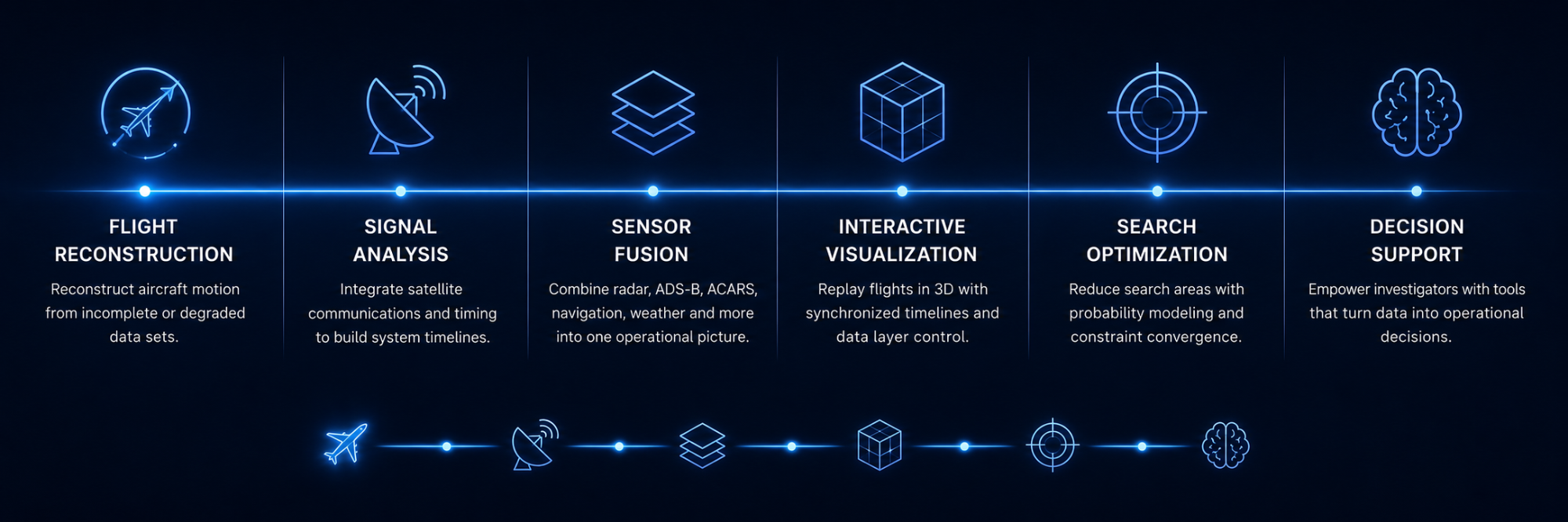
FLIGHT RECONSTRUCTION

February 2019 until Present
Flight reconstruction is the process of rebuilding an aircraft’s journey using information collected from many independent sources. Instead of relying on a single radar return, satellite message, or flight record, investigators compare navigation procedures, aircraft performance, communications, weather, maintenance records, and technical documentation to create a complete picture of what occurred.
SDMR brings these sources together into a single, connected framework. Each piece of evidence is synchronized, cross-referenced, and validated against every other source, allowing investigators to build a continuous timeline of events, identify inconsistencies, and reconstruct the aircraft’s most probable flight path with greater confidence. The result is a structured, transparent investigation where every conclusion can be traced back to the supporting evidence.
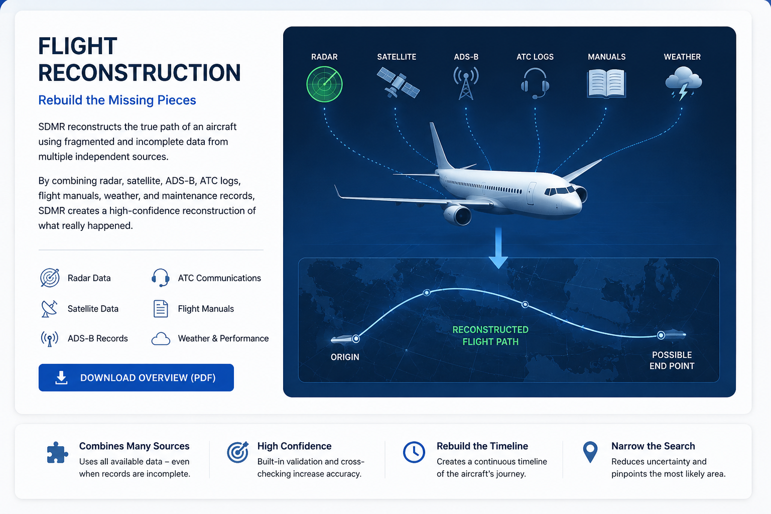
Flight Reconstruction Evidence Library
Aircraft Flight Crew Operating Manual (FCOM), Flight Crew Training Manual (FCTM), Quick Reference Handbook (QRH), Aircraft Maintenance Manual (AMM), Fault Isolation Manual (FIM), Wiring Diagram Manual (WDM), Aircraft Illustrated Parts Catalog (IPC),MultibeamEquipment List (MEL), Configuration DeMultibeamist (CDL), Master Minimum Equipment List (MMEL), Aircraft Systems Description Manual, Electrical Load Analysis, Weight and Balance Manual, Performance Engineering Manual, Flight Planning Manual, Fuel Multibeamocumentation, Navigation DatabaseROV Inspection Reports, Side Scan Sonar Imagery, Multibeam Procedures, Standard Instrument Departures (SID), Standard Terminal Arrival Routes (STAR), Enroute Airway Charts, Waypoint Database, Airport Charts, Approach Plates, Jeppese, Navigation Charts, ICAO Flight Plan, Flight Dispatch Release, Operational Flight Plan (OFP), Crew Flight Logs, Pilot Training Records, Air Traffic Control Voice Communications, ATC Radar Data, Military Primary Radar Returns, Secondary Surveillance Radar Records, ADS-B Data, Mode-S Transponder Data, ACARS Communications, Satellite Data Unit (SDU) Logs, Burst Timing Offset (BTO) Records, Burst Frequency Offset (BFO) Records ROV Inspection Reports, Side Scan Sonar Imagery, Multibeama, Satellite Drift Calculations, Ground Earth Station Logs, Radio Frequency Analysis, Doppler Shift Calculations, Signal Timing Analysis, Clock Drift Analysis, Frequency Stability Reports, Engine Health Monitoring Data, Rolls-Royce Engine Performance Records, Engine Trend Monitoring, Electrical System Monitoring, Power Distribution Records, Hydraulic System Documentation, Flight Control System Documentation, Autopilot Logic Documentation, FMS Navigation Logic, Waypoint Selection Procedures
ICAO Annex 13, ICAO Annex 2, ICAO Annex 6, ICAO Annex 10, ICAO Annex 11, ICAO Annex 15
ICAO Circulars, ICAO Navigation Specifications, ICAO Aeronautical Information Publications, NOTAM Records, AIP Publications, Weather Reports (METAR), Terminal Aerodrome Forecasts (TAF), Upper Air Wind Models, Jet Stream Analysis, Ocean Current Models, Sea Surface Temperature Data, Wave Height Forecasts, Drift Analysis Reports, Bathymetric Charts, Ocean Floor Topography, Hydrographic Survey Data, Search Area Probability Maps, Search Planning Reports, Underwater Acoustic Data, Locator Beacon Specifications, Flight Data Reconstruction Models, Simulation Results, Fuel Burn Calculations, Aircraft Performance Models, Navigation Constraint Analysis, Human Factors Documentation, Crew Resource Management Procedures, Boeing 777 Type Rating Documentation, Accident Investigation Reports, Safety Recommendations, Engineering Change Orders, Manufacturer Service Bulletins, Airworthiness Directives, FAA Advisory Circulars, EMultibeamy Information, Civil Aviation Regulations, Investigation Working Papers,Evidence Logs, Photographic Records, Witness Statements, Search Vessel Sonar Records ROV Inspection Reports, Side Scan Sonar Imagery, Multibeam Sonar Data, Search Grid Documentation, Probability Density Maps, Constraint Analysis Reports, Mathematical Models, Statistical Analysis, Timeline Reconstruction, Evidence Correlation Database, Cross-Referenced Investigation Records
For the best experience, download these resources for offline use. SDMR SYSTEMS uses common formats such as PDF, Microsoft Word, Google Earth (KML), videos, and interactive documents—no specialized software required.
SIGNAL ANALYSIS

February 2019 until Present
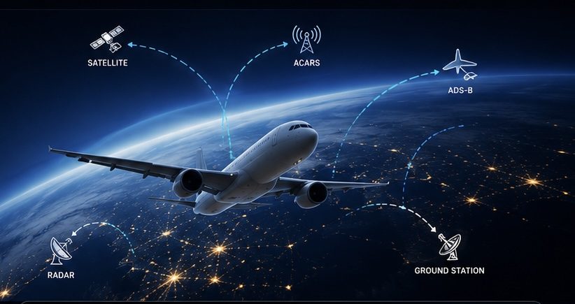
Aircraft constantly exchange information with satellites, onboard systems, and ground stations. Individually these signals are just numbers. Together they reveal aircraft behavior, timing, and system activity.
SDMR organizes these signals into one synchronized timeline so they can be compared with every other source of evidence.
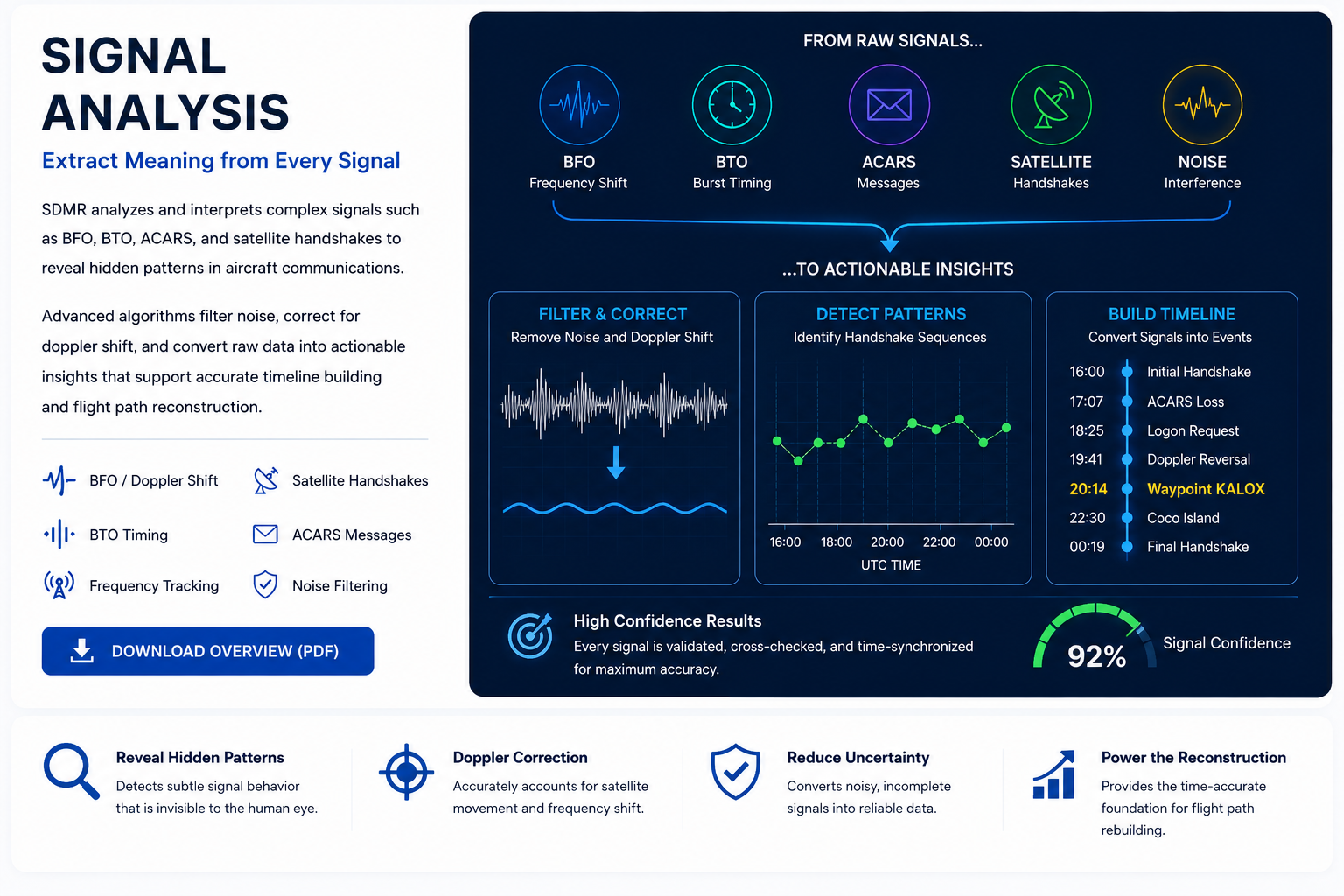
Signal Analysis - Every signal tells part of the story
For the best experience, download these resources for offline use. SDMR SYSTEMS uses common formats such as PDF, Microsoft Word, Google Earth (KML), videos, and interactive documents—no specialized software required.
SENSOR FUSION

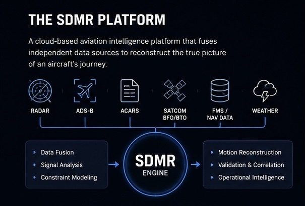
Modern investigations rely on many independent sources of information. Radar, satellite communications, aircraft systems, weather, navigation procedures, manuals, and operational records each describe the aircraft from a different perspective.
The challenge isn’t collecting the data—it’s connecting it.
SDMR’s Sensor Fusion engine synchronizes these independent sources into one unified timeline, allowing investigators to compare evidence, detect conflicts, and build a more complete understanding of events.
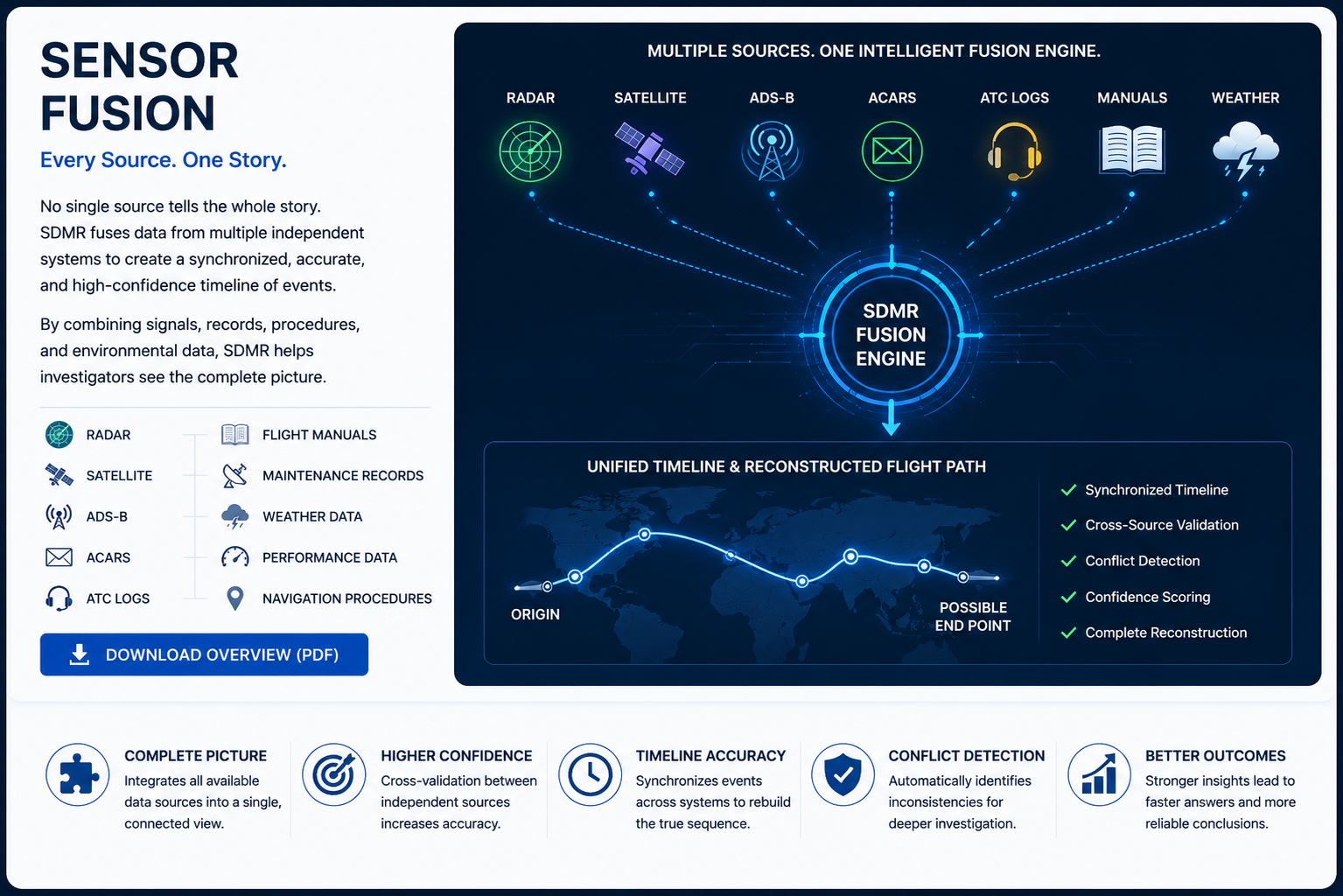
SENSOR FUSION - One Source Can Suggest. Multiple Sources Can Confirm.
For the best experience, download these resources for offline use. SDMR SYSTEMS uses common formats such as PDF, Microsoft Word, Google Earth (KML), videos, and interactive documents—no specialized software required.
INTERACTIVE VISUALIZATION

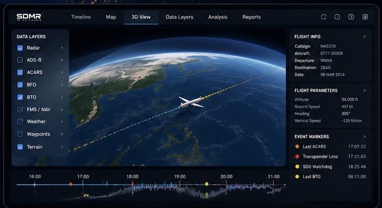
Modern investigations don’t suffer from a lack of information—they suffer from too many disconnected files. SDMR SYSTEMS brings maps, documents, signals, videos, and datasets together into one interactive workspace, making complex investigations easier to understand, review, and share.
See Every Piece of Evidence. Understand the Whole Story. Investigations generate thousands of files in dozens of different formats. SDMR SYSTEMS transforms those independent files into one interactive workspace where every map, signal, document, timeline, and model remains connected and easy to explore.
One Interactive Workspace: Instead of switching between PDFs, KML files, CSV datasets, Word documents, videos, and technical reports, SDMR SYSTEMS organizes everything into one connected investigation. Every source remains linked to the evidence it supports.
Understand Data Through Visualization: Complex information becomes easier to understand when you can see it. Interactive timelines, synchronized maps, live charts, animated flight paths, and linked evidence help investigators recognize relationships that are difficult to find in static reports.
Share, Secure, and Reuse Evidence: Projects can be packaged into secure evidence collections that are easy to distribute, archive, and review. Using common formats such as Microsoft Word, PDF, Google Earth (KML), CSV, images, and video means investigators can collaborate without purchasing specialized software.
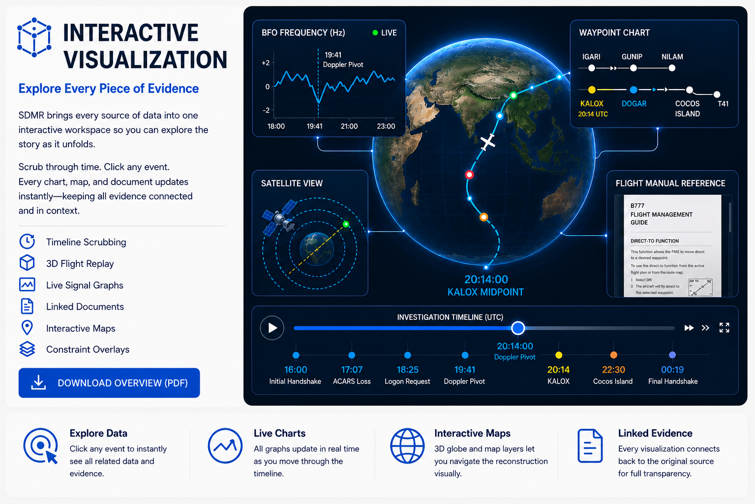
INTERACTIVE VISUALIZATION ⎯Every File Connected. Every Decision Supported.
Modern investigations rarely rely on a single source of information. Satellite tracks, KML files, CSV datasets, technical manuals, maintenance records, videos, photographs, engineering drawings, and operational reports all contribute to the investigation. Individually, each file tells only part of the story. Together, they reveal the complete picture.
The challenge is not opening these files—it is understanding how they relate to one another.
SDMR SYSTEMS transforms independent documents into an interactive investigation where timelines, maps, charts, signals, and supporting references remain synchronized. Instead of searching through folders and switching between software applications, investigators can explore every piece of evidence from a single workspace.
Using widely available formats—including Microsoft Word, PDF, Google Earth (KML), CSV, video, images, and animated documents—SDMR SYSTEMS allows organizations to share evidence securely without requiring expensive proprietary software. The result is a platform that is easier to deploy, easier to collaborate with, and easier to understand.
For the best experience, download these resources for offline use. SDMR SYSTEMS uses common formats such as PDF, Microsoft Word, Google Earth (KML), videos, and interactive documents—no specialized software required.
SEARCH OPTIMIZATION

Finding the right location isn’t about searching harder—it’s about searching smarter.
Search areas grow when evidence conflicts. Confidence grows when evidence agrees.
SDMR Search Optimization
- Constrain the search area using multiple independent sources.
- Validate target locations through cross-source agreement.
- Prioritize the highest-probability search zones before deployment.
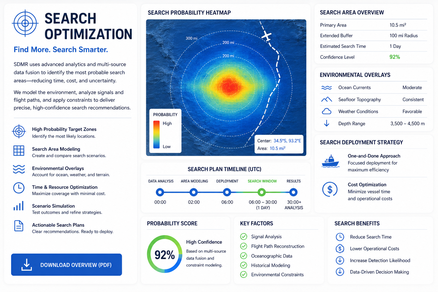
SEARCH OPITIMIZATION - Reduce the Search. Increase the Probability.
Finding the right location isn’t simply about searching harder—it’s about eliminating uncertainty. Every improvement in confidence reduces the area that must be searched, allowing investigators to concentrate resources where they matter most.
Traditional search strategies often begin with enormous search corridors that span hundreds of miles. As new models emerge, the search area shifts, vessels are redeployed, and valuable operational time is consumed revisiting large sections of the ocean.
SDMR SYSTEMS applies evidence integration, signal analysis, environmental constraints, and statistical modeling to reduce uncertainty before deployment. Instead of expanding the search, the objective is to continually narrow it—concentrating effort on the highest-probability locations first.
For the best experience, download these resources for offline use. SDMR SYSTEMS uses common formats such as PDF, Microsoft Word, Google Earth (KML), videos, and interactive documents—no specialized software required.
DECISION SUPPORT

Investigations fail when critical information is scattered across dozens of independent sources, making decisions slower, more expensive, and less reliable.
SDMR SYSTEMS restores confidence by transforming thousands of disconnected pieces of information into one clear operational picture—where evidence becomes insight, and insight becomes confident decisions.
Connect every source into one complete operational picture.
Evaluate every scenario before committing people, vessels, or aircraft.
Deploy with confidence while reducing time, cost, and operational risk.
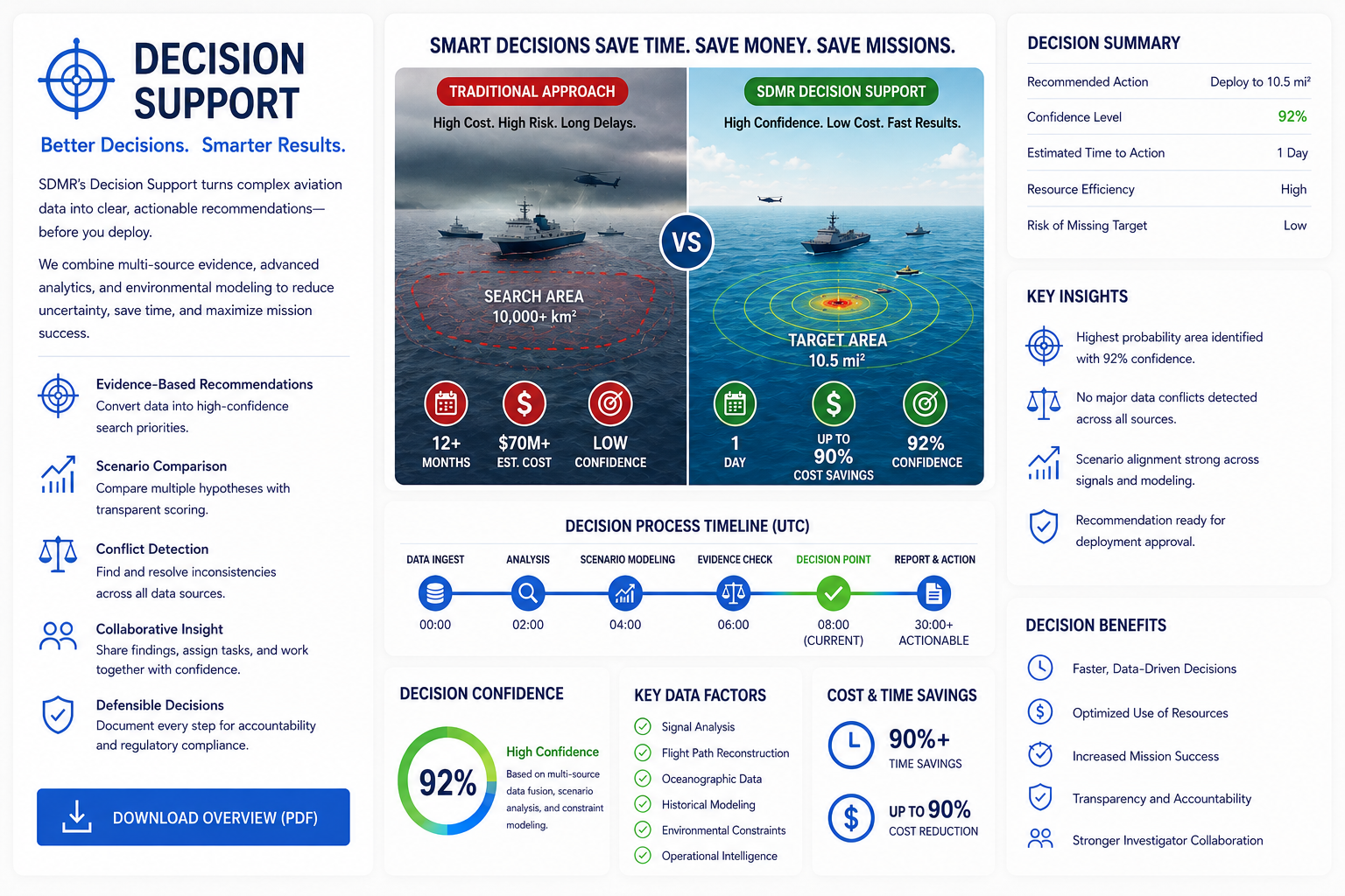
DECISION SUPPORT - Better Decisions Begin with Better Evidence.
The search for Malaysia Airlines Flight MH370 demonstrates one of the greatest challenges in modern investigations. The difficulty is not simply finding an aircraft—it’s making the right decisions before the search even begins. Every deployment depends on incomplete information, changing environmental conditions, limited weather windows, vessel availability, and significant operational commitments.
In deep-ocean investigations, time is governed as much by nature as by technology. Seasonal weather, sea state, and logistics determine when search vessels can safely operate. Every delay, route adjustment, or expansion of the search area increases operational complexity, while every deployment represents a major investment of personnel, equipment, and planning.
Traditional search strategies often require investigators to examine large areas because uncertainty remains high. As new information becomes available, search plans may evolve, requiring resources to be redirected or priorities to be reassessed. This iterative process is a normal part of complex investigations, but it can also extend timelines and increase the scale of operations.
SDMR SYSTEMS approaches the problem differently. Instead of beginning with the largest search area and refining it over time, SDMR is designed to integrate independent evidence, compare competing scenarios, and rank search opportunities by confidence before deployment. The objective is not simply to search more—it is to begin with the strongest evidence, make informed decisions earlier, and deploy resources with greater confidence.
For the best experience, download these resources for offline use. SDMR SYSTEMS uses common formats such as PDF, Microsoft Word, Google Earth (KML), videos, and interactive documents—no specialized software required.